CBC 2 : Swords to City Centre Round 3 Submission
Core Bus Corridor 2: Swords 16th December 2020
1.0 Introduction Dublin Cycling Campaign is a registered charity that advocates for better cycling conditions in Dublin. We have a vision for Dublin that is a vibrant city where people of all ages and abilities choose to cycle as part of their everyday life.
2.0 Cycling for All The goal of the cycle routes must be to enable people of all ages and abilities to cycle. Cycling can be an option for almost everyone if we design for it correctly.
If the cycle routes do not measure up to international best practices we will not see kids cycling to school with their parents, teenagers cycling to the cinema, commuters cycling to work or older people cycling to the shops.
Only by enabling many people to cycle, by making it a realistic choice, can we deliver the potential modal shift changes. Whenever a new person starts cycling society reaps the benefits of improved public health, reduced congestion, and better liveability for our urban places. The maximum benefits of cycling are only achieved by designing cycle routes that enable the largest cross-section of society to cycle.
3.0 General Points and Summary Road redesign or traffic light resignaling should not introduce circuitous routes or delays for cyclists and pedestrians, instead any delays should be levied proportionally or road users in accordance with the space taken per person, i.e. private motor cars should be apportioned more delays than buses, pedestrians or cyclists on the basis that private motor vehicles typically consume a larger area of road space per person. There have been significant improvements to the junction design along CBC02. Many “Orphaned” cycle lanes have been removed, which greatly enhances cyclists’ safety at junctions. Whilst there are reservations about the proposed junction design not matching accepted best practice internationally. It is also to be applauded the significant increase in “Bus Stop By-passes” along the route. Previously many bus stops along this route were part of the cycle lane. Removing this potentially dangerous interaction between cyclists and pedestrians will benefit the safety of them both.Bus stop bypasses are recommended by the NTA’s National Cycle Manual given the frequency of buses along this route. It is welcome to see so many bus stops by-passed on the Fingal portion of the CBC. There are significant concerns regarding the width of the cycle lane as they by-pass the bus stops. Maintaining an appropriate width, especially when there’ll be inevitable interactions with commuters crossing the cycle lane to board/alight busses is critical. It is hoped that a minimum width of 2.5m will be maintained on these bus stop by-passes. Furthermore, it is very positive to witness the designs of junctions integrating future routes of the Greater Dublin Area Cycle Network (GDACN). Junctions such as Pinnock Hill (Map 1, PRO Report) and Airside (Map 3, PRO Report) which integrate the GDACN Route SW5 and Route SW6 respectively will be crucial in ensuring that these junctions will seamlessly integrate with the proposed GDACN network, as included in the “Do Minimum” analysis in the Draft Transport Modelling Report. Cyclists travel at speeds between 15km/h and 30 km/h and therefore should be given the option to overtake other cyclists for stretches of cycle lane exceeding 200 meters in length, this should be provided for by use of short stretches of cycle lane of 2.5 meters in width, this width will facilitate cargo bikes and bike trailers. Leaving the cycle lane to use adjoining paths or roads should not be considered safe for a bus corridor. The target quality of service for primary routes in CNP is A+/A. Below is an extract from section 2.3 of the Written Report of CNP, which outlines the desired width of primary cycle routes as 2.5m. Figure 1 Target Quality of Service for Primary Cycle Routes according to the Greater Dublin Area Cycle Network Plan We recognise that achieving a 2.5m wide cycle track on all portions of this route may be challenging, however it is possible to achieve this width on large segments of the CBC. The NTA’s National Cycle Manual (NCM), section 1.7.4, requires that there is a buffer space of either a hard paved area or grass verge between the cycle track and the roadway when the AADT and 85th percentile speeds are both high, such as Swords Road. This buffer space increases the comfort level for cyclists (one of the five needs of a cyclist). It also allows for overtaking using the full width of the cycle track, without partially overhanging the adjacent lane. We encourage the design team to, where possible, match the design of “Cycle Track Behind Verge” on page 67 of the NCM, which has grass/planted buffer between the cycle track and the road.
Figure 2 Guidance Graph on Buffer Widths for Cycle Lanes from NTA National Cycling Manual There is no guidance within the NCM for the size of this buffer space (the area marked in blue in the cycle track image above). However, this design guidance from the UK maybe useful: UK Interim Advice Note 195/16 for Cycle Traffic and the Strategic Road Network.
Figure 3 U.K. Guidance on Buffer Widths for Cycle Lanes
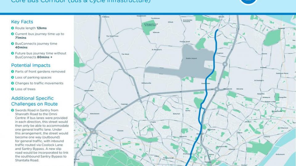
The lack of an appropriate buffer between cyclists and high speed traffic is of particular concern along the first section of the route (R132) from Swords to the M50. Most notably, at the junction of Pinnock Hill (Map 1, PRO Report), Airside (Map 3, PRO Report) and Cloghran (Map 6, PRO Report), which appear to offer no buffer between cyclists and traffic. The R132 has a high AADT and a 60km/h speed limit. Another area of concern is for the cyclist diversion parallel to the N50 Santry Bypass, which also has high AADT and a 60km/h speed limit.
The Busconnect’s brochure mentions ‘dedicated bus lanes’ Core Bus Corridor (CBC): Part of the overall BusConnects Programme is to create 16 radial core bus corridors (CBC). A CBC is an existing road with bus priority so that buses can operate efficiently, reliably and punctually. This generally means full length dedicated bus lanes on both sides of the road from start to finish of each corridor or other measures to ensure that buses are not delayed in general traffic congestion. The bus lanes will be alongside segregated cycle lanes The use of the word ‘dedicated’ is understood that it will be illegal for cyclists to cycle in the bus corridor, and even if not made illegal, cyclists can expect so-called punishment passes from bus drivers who do not welcome cyclists on ‘dedicated bus lanes’, therefore the quality of cycle lanes that are proposed must be designed to a standard that is far superior than what is currently being proposed and prepare for this change and encourage greater use of the cycle lane. The National Transport Authority has developed its own unique layout for junctions, but there are significant reservations about best practice international designs for cycling junctions being ignored. The primary concern with the NTA’s unproven design concept is that people cycling are not being given clear protection from left-turning vehicles. This is a core principle of international best practice for protecting cyclists at junctions. The NTA’s design will give left-turning motor vehicles and people cycling straight ahead a green light at the same time. Multi-modal travel between bike and bus could be encouraged as these designs progress. A first step would be to provide sheltered Sheffield stands near bus stops along this route, giving a particular focus to where orbital cycle routes intersect with this Core Bus Corridor. Given the CBC will host a super high-frequency bus route the desire for people to cycle to the CBC makes multimodal travel likely if correctly encouraged. 4.0 Location Specific Points Map 1: The cycle lane at Pinnock Hill roundabout in Swords no longer starts and ends abruptly, this is welcome. However, there is only 640m of GDACN Primary Route 2A that is not being provided as part of this Core Bus Corridor. This section would connect cyclists directly into Swords village. Delivering a coherent network that allows cyclists to safely travel into their local village is an essential factor to increase uptake and support the Modal Shift desired by Fingal County Council and NTA. Presently, the proposed cycling route leaves cyclists just over 0.5km outside the town at the Pinnock Hill junction. It is vitally important that the cycling route, particularly primary routes, connect our suburban villages to the city centre, not near outside them. We would implore NTA to add a section to this scheme in order to complete this missing link. Map 5: An advance stop line for cyclists should be provided on Kettles Lane. Map 6: Eastbound cyclists are afforded a short 10 meter cycle lane when approaching the existing Coachmans Inn roundabout, whereas a longer (20 meter approx) section, comprising two lanes , are provided for motor vehicles, this should be reversed to allow cyclists to filter safely through queuing traffic. Map 7: A circuitous cycling route at Dublin airport is proposed for cyclists heading south towards Dublin at the main Dublin Airport roundabout, while preserving two lanes for motor vehicles. Map 8: Cyclists must cross 6 lanes of traffic separated by 2 traffic islands/central medians, it is not clear from the proposed design if cyclists must yield for traffic lights three times when crossing these lanes. Currently motorists and cyclists must yield to traffic lights twice while on the roundabout whether heading south or north, therefore the proposed design must not cause cyclists to yield more than twice (particularly as motorists will continue to yield twice). Map 8: A southbound cycle lane starts just south of the airport roundabout, yet there is no way to join that cycle lane Map 9: It appears that no proposal has been made to amend the existing cycle lanes on map 9, given that the current design allows cyclists to legally cycle in the bus lane and the proposed bus corridor will exclude cyclists, the cycle lane should be improved to a higher standard than what exists today. The cycle lane immediately outside Kealys Pub at Dublin airport is disrupted by both an entrance and exit to and from the pub, while at the same time two lanes are preserved for private motor traffic that is not disrupted. Traffic entering or exiting the pub should be met with a yield sign to allow cyclists to pass uninterrupted, and the cycle lane should be straight so that cyclists do not have to slow to negotiate turns that lead across these entrances and exits. Similarly, the the opposite side of the road to Kealys pub, entrances to car hire depots and other industrial units currently disrupt the cycle lane, but no such interruption applies to the two lanes of motor traffic, this should be improved to allow cyclists continue straight uninterrupted apart from a the same number of traffic lights that motorists and cyclists currently face. Providing cycle lanes across slips lanes is not recommended by the NTA’s National Cycle Manual (section 4.4.4). These slip lanes should be removed (DMURS 4.4.3) or converted into pocket turns where complete slip lane removal isn’t possible. Map 10: Northbound cyclists currently have a choice between a safe but circuitous route through the junction or remaining in the bus lane, whereas in the proposed design cyclists must take the circuitous route disrupted by three traffic islands. This junction should be redesigned to allow northbound cyclists to continue with less disruption and less circumnavigation. Cyclists exiting the airport via the airport’s cycle lane have to dismount and cross the junction to join the cycle lane on the eastern side (southbound), this is not optimal and will lead to cyclists continuing in the wrong direction up the northbound cycle lane. There is extensive use of shared paths We understand that many of these spaces would have a reduced volume for pedestrians. We’d encourage the NTA to upgrade the existing shared paths along this section to create continuous cycle paths. This would also fulfil the design requirement of 2.5m wide lanes along primary cycle routes as detailed in the NCM. Shared paths are discouraged by the NTA’s National Cycle Manual (section 1.9.3) as they provide a poor quality of service for both pedestrians and cyclists. Cyclists on shared surfaces must also cycle slower in order to safely share the space. Given the distance of Swords from even the north city the route will only be attractive if cyclists can achieve some speed. Map 11: the shared pedestrian and cycle route will be replaced with segregated routes which is welcome, however, a short stretch of wider cycle lane should be provided for cyclists to overtake one another safely. The use of traffic calming measures on some local access roads that join this route reinforces the prioritisation of pedestrians and cyclists. The western (airport) side of the road sees traffic calming measures implemented whilst the two side roads opposite do not. Such techniques should be the norm, not the exception. We would like to see them extended along the whole route. The use of continuous footpaths and cycle tracks over side roads will encourage pedestrian and cyclist priority and increase safety. We’d also like to see corner radii analysed along the route.
Maps 13 & 14: a similar short stretch of wider cycle lane should be provided for cyclists to overtake one another safely. Map 15: The cycle lane existing Airways Industrial Estate should be as long, or longer than the lane of traffic alongside it. Map 16: The improvements here are generally an improvement over the existing arrangements, however, it appears that cyclists entering Northwood are expected to dismount and use the pedestrian traffic lights; which is a poor design. Map 17 & 18: The proposed northbound cycle lane is disrupted three times when there appears to be sufficient space for motor vehicles (except HGV’s) existing Santry Stadium to cross a protected cycle lane and then safely join the passing road, therefore the cycle lane should be protected at these three junctions. Map 19: Cyclists joining Santry Avenue will have to dismount and use the pedestrian crossing, or cross the bus corridor. Map 20: The quiet street is regularly filled with cars parked outside houses on both side of the street with barely enough space for cars to pass between them, this puts northbound cyclists in conflict with motor vehicles heading in the opposite direction on the street, parking should be restricted to one side or the other in order to make it safe to cycle on this quiet street. Map 21: In the event that a change in law results in cyclists being excluded from bus corridors this stretch of the route should be downgraded to a bus lane to share the space with cyclists (as is the case today along most of this stretch). Map 26: The quiet street is regularly filled with cars parked outside houses on the western side of the street, cyclists heading southbound will be in conflict with oncoming cars that are passing these parked cars. The grass verge could be utilised to provide parking without sacrificing trees so that parking outside houses can be limited along short stretches to provide passing opportunities and reduce this conflict. Map 31: Parking spaces should leave a space for car doors to open, while this appears on map 31, the artist’s impression accompanying it doesn’t show this space. Map 32: Southbound cyclists turning right onto Botanic Avenue must leave the cycle lane and cross three lanes of traffic or dismount and use the pedestrian crossing, a better solution is needed to facilitate cyclists, such as the junction design proposed elsewhere along the route (e.g. Map 15) Map 33: Northbound cyclists are disrupted on three occasions, whereas northbound buses and motorists are not, in the event that cyclists are excluded from the bus lane the design must be improved so that cyclists are disrupted no more or no less than motor vehicles and buses. Map 34: Southbound cyclists turning right onto Whitworth Road must leave the cycle lane and cross three lanes of traffic or dismount use the pedestrian crossing, a better solution is needed to facilitate cyclists, such as the junction design proposed elsewhere along the route (e.g. Map 15)
Glenn Wearen Secretary of Fingal Cycling sub-group Dublin Cycling Campaign ℅ Tailor’s Hall, Back Lane, Dublin 8
Registered Charity Number (RCN): 20102029
How to engage : We are inviting submissions in relation to the Preferred Route Options. The closing date for submissions is the 16th of December 2020.
Written submissions and observations may be made by: Email to cbc@busconnects.ie
Help us do more for cycling in Dublin by becoming a member!