Dublin Bay By Bike Interactive Map
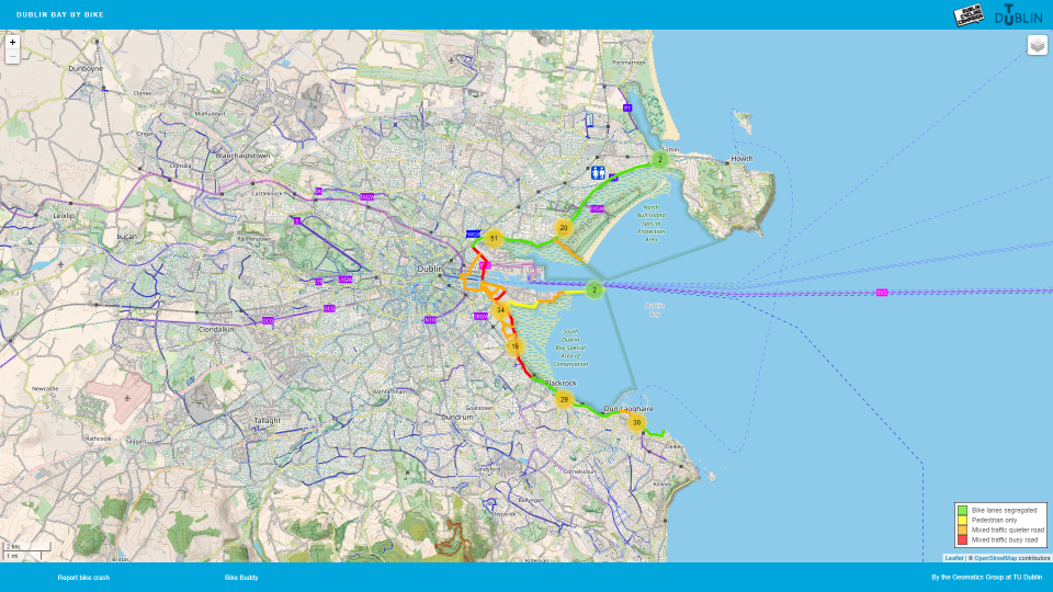
Dublin Cycling Campaign has collaborated with the Geographic Science (Geomatics) school in TU Dublin to create an interactive cycle map of Dublin Bay.
The interactive map helps people to plan their cycle routes around Dublin Bay and outlines which sections of the route are segregated from or mixed with motor traffic.
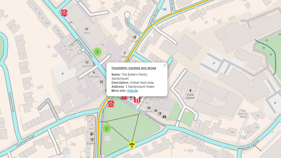
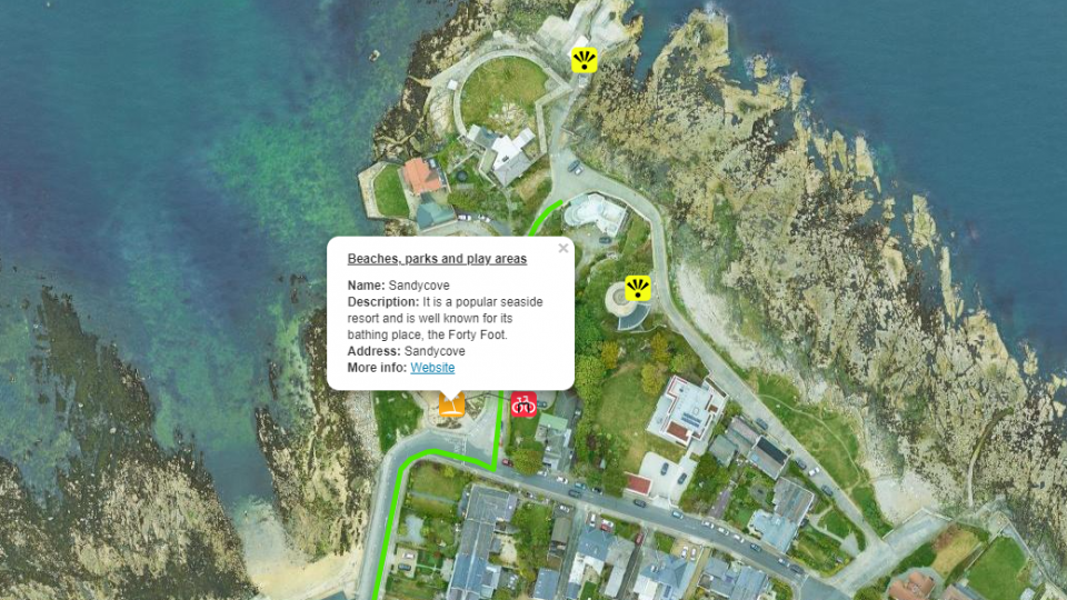
The #DublinBayByBike map also shows the various amenities along the route, including toilets, cycle parking, beaches, playgrounds, places to eat and places of interest.
We intend to continue updating the map as (hopefully) new segregated cycle routes are added around Dublin Bay, and we’re also looking to work with local historians to add to the places of interest on the map.
We’d like to say a big Thank You to all the children who contributed to local research!
Try out the map for yourself here: dublinbaybybike.ie/
Help us do more for cycling in Dublin by becoming a member!