CBC5: Blanchardstown to City centre Round 3 Submission
Core Bus Corridor 5: Blanchardstown 16th December 2020
Please feel free to use this information in your own submissions. PDF version attached which is easier to read with images.
1.0 Introduction Dublin Cycling Campaign is a registered charity that advocates for better cycling conditions in Dublin. We have a vision for Dublin that is a vibrant city where people of all ages and abilities choose to cycle as part of their everyday life.
2.0 Cycling for All The goal of the cycle routes must be to enable people of all ages and abilities to cycle. Cycling can be an option for almost everyone if we design for it correctly. If the cycle routes do not measure up to international best practices we will not see kids cycling to school with their parents, teenagers cycling to the cinema, commuters cycling to work or older people cycling to the shops. Only by enabling many people to cycle, by making it a realistic choice, can we deliver the potential modal shift changes. Whenever a new person starts cycling society reaps the benefits of improved public health, reduced congestion, and better liveability for our urban places. The maximum benefits of cycling are only achieved by designing cycle routes that enable the largest cross-section of society to cycle.
3.0 General Points and Summary
It is disappointing to see the lack of support for active travel (pedestrians and cyclists) in many of the Fingal County Council area elements of the CBC. The Preferred Route Options Report (PRO) frequently stresses the importance of designing for cyclists and pedestrians yet frequently prioritises motorised traffic. This is compounded by the fact that only one day of pedestrian surveying was carried out along the route (256 19344 Bus Connects Route 5 14 Hour Ped — Report) and no surveying of cyclists (256 19344 Bus Connects Route 5 ATC). A system cannot be designed for the movement of people when the movement of the people is not accurately recorded. A safe cycling network, to function appropriately, must be coherent, direct and provide as much segregation from motorised traffic as possible. There are several national documents produced by the NTA to advise and guide on the design requirements for active travellers such as Design Manual for Urban Roads and Streets (DMURS) and the National Cycling Manual (NCM). These offer clear design requirements to be met to ensure the safety and usability of the network. The provision for cyclists along the CBC5 route is largely positive. Segregated, direct cycle tracks are required if a modal shift is to occur, an objective of Fingal County Council. Redesigning junctions accordingly can be a significant challenge. Regrettably, it is largely at junctions that the proposed designs fail to meet the design criteria detailed in the likes of NCM or DMURS alongside more egregious shortcomings in a complete absence of designing for future integration of cycling routes implemented under the Greater Dublin Area Cycle Network (GDACN).
The report frequently states the importance of integration with future infrastructure projects such as the expansion of the N3 (which does not have planning permission yet) and the GDACN. In the traffic modelling report for Blanchardstown CBC 05; in Table 8.1 in Section 8.5 “2028 and 2043 Forecast Year Scheme Definition” The modelling assumes the implementation of the Greater Dublin Area Cycle Network Plan in both “Do Something” and “Do Nothing” scenarios for both five (2028) and fifteen (2043) year forecasts. This provides convincing evidence that at a minimum it is assumed that the GDACN will be implemented.
Section 4.5 of the Emerging Preferred Route report “Integration with Other Road Users” unambiguously states that relevant cycle routes planned under the GDACN will be integrated into the design plans.
“Specifically, Primary Cycle Route 4, 4B, 4D and 5, and Secondary Route 4A, 2C,C8, NO1 and NO5 from the Greater Dublin Area Cycle Network Plan run along, or are intercepted by, the Blanchardstown to City Centre CBC, with their provision considered at all stages of the option assessment process. The interaction of the CBC with other schemes progressing through the planning
and design process has also been considered, specifically the Royal Canal Greenway and the Tolka Valley Cycle Route. The interaction of the CBC with other cycle route schemes progressing through the planning and design process has also been considered in the design process, specifically the Grangegorman Campus Development and the Liffey Cycle Route Scheme.”
Furthermore, Section 7.4.3.2 “Walking & Cycling” states:
“The provision of dedicated cycling infrastructure along the CBC as well as on parallel routes in some cases, would improve the level of service provided for cyclists along the route, making cycling trips safer and more attractive. The scheme would deliver substantial elements of the GDA Cycle Network Plan as outlined in Section 4.5, as well as linking with other proposed cycling schemes, contributing towards the development of a comprehensive cycling network for Dublin.”
These statements clearly demonstrate the importance of appropriate design for active travel in addition to the critical importance of integrating BusConnects into the GDACN. However the design of some junctions, detailed below, as well as the complete absence of integration with major cycle routes, also detailed below, are of extreme concern.
BusConnects is a once in a generation investment in our bus and cycling network. It is routinely marketed as a major cycling infrastructure project. The importance of integration with the cycle network is routinely stressed as stated in the above excerpts, yet this importance is simply not reflected in the detail of the designs. Ashtown Roundabout is set to be a major fulcrum for the cycling network in Dublin West, yet the plans do not incorporate any of the major cycle routes at this junction.
The dichotomy of designing for future motorist use with the absence of design for future cycling use is laid bare in how these major junctions are designed. Future increases in road capacity are designed into the junctions and system yet there seems to be little acknowledgement of key routes of the GDACN in the junction design.
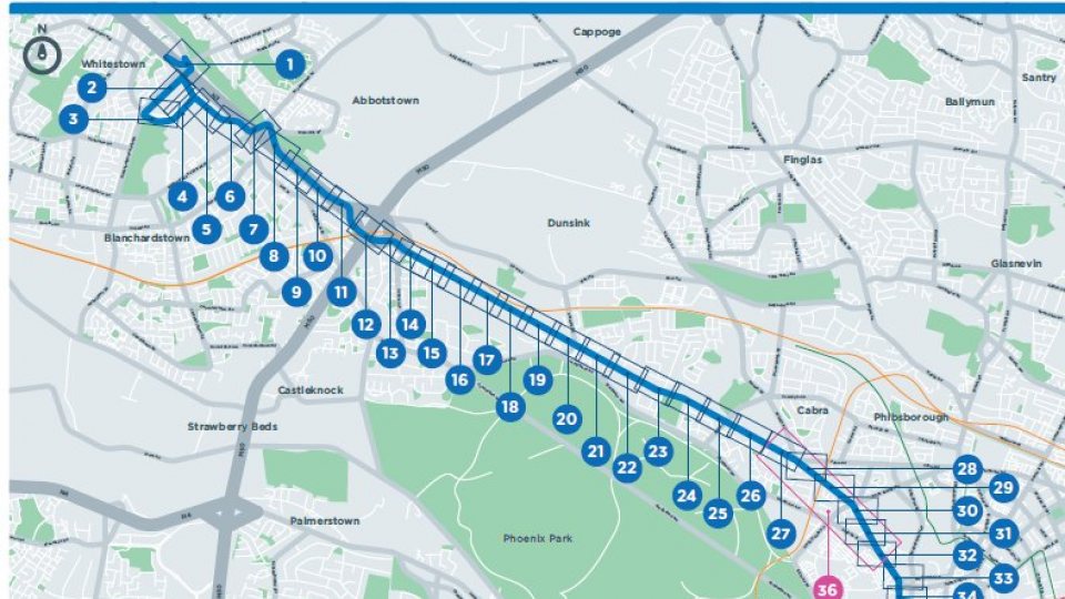
4.0 Location Specific Points Improvements The updated design of the Blakestown Junction (Figure 1) to accommodate more cycling movements in all directions is a welcome improvement over the previous designs. Removing the cycling hostile roundabout and implementing a segregated design approach dramatically increases the usability and safety for cyclists at this junction. Figure 1 Improved Junction Design Blakestown and Blanchardstown Shopping Centre Routing cyclists along a “Quiet Street” on Castleknock Manor adjacent to the Navan road reduces the need for “Land Take” whilst providing a more comfortable, alternative route for cyclists further removed from the heavy traffic of the Navan road. It would also better align cyclists with the M50 pedestrians/cycling overpass on the Old Navan road.
The increased cycle track width from 1.75m to 2.00m in Map 25 is a very welcome improvement. A small increase in the width of cycle tracks can have significant positive effects to cyclists, further increasing the likelihood of modal shift. The reduction of shared space between pedestrians and cyclists at the junction at Cabra Garda Station (Figure 2) is a substantial improvement over the previous iteration. Removing shared space between pedestrians and cyclists is recommended in the NCM Section 1.9.3. It is encouraging to see the designers endeavour to provide as much segregation as possible for pedestrians and cyclists. Furthermore, the increased segregation enables a “bus stop by-pass” at Roosevelt Cottages. Signalising the Glenbeigh road junction is a simple, yet effective solution to reduce the probability of rat running through Glenbeigh road. This was needed to cope with potentially increased traffic resulting from the bus gate on Old Cabra road. The improvements to the public realm in Stoneybatter is significant. Repurposing much needed public space from vehicles to people is to be highly commended. The reallocation of this space affords the opportunity to increase space for pedestrians and cyclists alike. It will be hugely beneficial to Stoneybatter village. A more vibrant, welcoming urban village as a result of prioritising the movement of people rather than vehicles.
Slip Lanes Providing cycle lanes across slips lanes is not recommended by the NTA’s National Cycle Manual (section 4.4.4). These slip lanes should be removed (DMURS 4.4.3) or converted into pocket turns where complete slip lane removal isn’t possible. Furthermore, these slip lanes increase crossing movements for both cyclists and pedestrians. A pedestrian wishing to cross from one side of the Blanchardstown road south, Figure 4, to the other; is forced to make five crossing movements. This clearly does not meet the objective detailed in Section 3.2 of the Transport Modelling Report:
“To support the ‘Objective’ led approach to the design of junctions along the Proposed CBC (i.e. with a focus on the movement of people rather than vehicles), a People Movement at Signal (PMS) Calculator has been developed from first principles based on TRL guidance2. The ‘Objective’ led approach involves the prioritisation of people movement, focussing on maximising the throughput of sustainable modes (i.e. Walking, Cycling and Bus modes) in advance of the consideration and management of general vehicular traffic (private car) movements at junctions.” Absence of Cycle Facilities Between Snugborough Road and Auburn Avenue It is unclear if there will be provision for cyclists between Snugborough Road and Auburn Avenue. The Preferred Options Report states there should be segregated cycling facilities through Blanchardstown Village, but no details are provided about exactly what these upgrades would entail.
Overpass Navan Road Phoenix Park Racecourse Map 17 Figure 5 Future Entrance to Edmund Rice Post Primary School (Navan Road Overpass at the Phoenix Park Racecourse) Significant shared space with pedestrians here, contradicting NCM Section 1.9.3. This junction will become the entrance to the new Edmund Rice Post-Primary school due to be completed in 2021. Consequently, cycle facilities should be kept separate from pedestrian movements and this junction should be upgraded to accommodate a 1,000 student school. Cycle and pedestrian facilities should be prioritised and segregated in accordance with the Transport Modelling Report and NCM guidelines respectively. There should be cycle facilities designed to integrate with any cycling facilities resulting from the school’s construction. A “raised entry treatment” should be strongly considered for this crossing to assert that pedestrians and cyclists do in fact have priority. Navan Road Phoenix Park Avenue Map 19
Figure 6 Entrance to Phoenix Park Avenue, Navan Road Cycle and pedestrian facilities should be prioritised and segregated in accordance with the Transport Modelling Report and NCM guidelines respectively. A “raised entry treatment” should be strongly considered for this crossing to assert that pedestrians and cyclists do in fact have priority.
Ashtown Roundabout Map 20
Junction design requirements are clear, the movement of people through junctions takes precedence over private vehicles. The objective-led approach detailed in Section 3.2 of the Transport Modelling Report supports that the movement of people, cyclists and busses are to be prioritised in the design process.
Figure 7 Schematic of Ashtown Roundabout
Ashtown roundabout fails to meet this objective. Ashtown roundabout will be a major cycling interchange for Dublin West. It will link the Tolka Greenway, The Royal Canal Greenway, GDACN Primary Radial Route 4A and GDACN Orbital Route 6. Despite this, there are no dedicated cycling crossings nor are the aforementioned routes designed for at this junction. Some easily identifiable issues include;
Cyclists are forced into shared areas with pedestrians (use not recommended in NCM section 1.9.3).
The road crossings are shared crossings.
Cyclists going eastbound into the city centre will be forced to cross two roads to get back onto the appropriate cycle track.
The two-way cycle track is merely 75cm wider than the one way cycle track continuing into the city centre.
The cycle tracks stop abruptly when they are most essential.
The cycle tracks do not follow NTA guidelines by designing cycle tracks that are as direct as possible.
The lack of information and detail surrounding Ashtown roundabout strongly suggests that cyclists and pedestrians have not been prioritised in the design of this junction. Thus failing to meet the objective as laid out in Section 3.2 of the Transport Modelling Report.
“At Ashtown Road junction, it is proposed to terminate the two-way cycle track on the R147, west of the junction, and to transition to a one-way cycle track on each side of the Navan Road carriageway”
The NCM (P. 68) stipulates that a two way cycle track should be a wider track to allow more comfort and easier overtaking for cyclists and that a key issue to be considered is the design of junctions and crossings and their approaches. Section 2.3 of the Written Report of Greater Dublin Area Cycle Network Plan, outlines the desired width of primary cycle routes as 2.5m.
Figure 8 Target Quality of Service for Primary Cycle Routes according to the Greater Dublin Area Cycle Network Plan
A minimum target width of 4m should be the aim for primary route two-way cycle tracks, such as those on the Navan road. The proposed two-way cycle way on the Navan road will be 2.75m. This is only 75cm wider than the single lane cycle track that will carry cyclists into the city centre. An extra traffic lane providing a dedicated right turn lane for motorists going eastbound directly impacts on the amount of space available for the cycle track in addition to the insufficient buffer space between the cycle track and road. This new dedicated right hand turn lane provided for motorists contradicts the statements that private vehicles will not be prioritised whilst failing the design requirement as laid out in Section 3.2 of the Traffic Modelling Report.
The lack of detail regarding integration with proposed major cycle infrastructure is indeed alarming. Particularly when integration is mentioned for part of the cycle track 1km west at Castleknock Manor.
“This cycle facility would tie into the proposed Greater Dublin Area Proposed Cycle Network that connects to Old Navan Road via Castleknock Manor”
There is no mention of integrating Ashtown roundabout with the wider GDACN. These serious shortcomings in design must be resolved before delivering the project.
Set-down and Parking Outside Our Lady Help of Christians Parish Church Map 24
Figure 9 Set Down Area Our Lady Help of Christians Parish Church
The set down area has been marginally improved with the kerb buildout to prevent cars from using it as an entrance way to the school. Unfortunately, there remains a conflict between cyclists and vehicles using the set-down area. Utilising the space for a cycle track would enable the creation of a bus stop bypass at this location. It is worth noting that this area is currently marked by the ‘school - keep clear’ markings that disallow parking or set down.
Navan Road/Cabra Road Junction
Figure 10 Navan Road/ Cabra Road Junction
The increased cycling provision at the Navan road/Cabra road junction results in a substantial reduction in shared space. It has the added benefit of giving cyclists more direct route options. There is concern over the diagonal crossing route for cyclists travelling along the Old Cabra road. How will this crossing be catered for in traffic movements? Cyclists will need their own priority to be able to safely traverse three lanes of traffic. Furthermore, the junction is missing a dedicated pedestrian crossing from the Cabra Library side to the Pine Hurst side.
Prussia Street Figure 11 Schematic Detailing No Cycle Track on Prussia Street A complete outbound cycle track on Prussia St will encourage a greater modal shift than what is currently proposed. Many potential cyclists do not cycle due to the perceived risk of sharing space with vehicles. A continued cycle track along Prussia Street would provide cyclists a segregated safe route to Park Shopping Centre, the North Circular road and beyond to Castleknock. The design team might consider a continuous outbound cycle track on Prussia St. This should not be coupled with a reduction in footpath width.
Brunswick Street Figure 12 Schematic Illustrating North Brunswick St/ Stoneybatter Junction The bus-priority lights should be relocated so Brunswick Street section can be pedestrianised like previous iterations of the design. This would offer a huge improvement to the public realm and fulfil the criteria of the public realm improvement component of BusConnects. It would also provide more space to people walking and cycling on Brunswick Street instead of the proposal shared space and share toucan crossing, which will lead to serious conflict between the volumes of people walking and cycling at this location. Cycle track on Queen Street The 2.8m (Figure 14) bufferless bidirectional cycle track proposed for Queen Street is too narrow, particularly at junctions. The widths were measured using ImageJ Software Analysis (Rasband, W.S., ImageJ, U. S. National Institutes of Health, Bethesda, Maryland, USA, https://imagej.nih.gov/ij/, 1997-2018.) Figure 13 shows that the road width for motor vehicles on Queen St is 7m. This equates to two 3.5m vehicle lanes on a street that is supposed to prioritise the movement of people rather than vehicles (Section 3.2 Transport Modelling Report). Figure 13 Schematic Illustrating Width of Queen Street using ImageJ Software Analysis Figure 14 Schematic Illustrating Width of Cycle Track on Queen Street using ImageJ Software Analysis An alternative option would be to reduce the number of traffic lanes from 3.5m to 2.8-3m each. Queen Street is a 30km/h road with only one traffic calming measure (kerb build-out after Blackhall Place Junction). Reducing the traffic lane width would provide consistent traffic calming along the entire route. The extra 50-90cm should be used to widen the cycle track and install a buffer. Furthermore, cycle lanes will be provided on Liam Mellows Bridge to link Queen St and Bridgefoot St. Consequently, there will only be sufficient space for one traffic lane. Heuston Station bound traffic will be required to be diverted down Blackhall St to cross the river Liffey at James Joyce Bridge. That measure will remove nearly half the traffic on Queen St beyond the Blackhall St junction. Consequently, an entire traffic lane for the relatively small number of vehicles that turn left onto the Quays is not an efficient use of that public space. Secondly, there is a missing crossing / shared space at the junction of Blackhall Street / Blackhall Place (Figure 14). This absence can be easily resolved in future iterations. Conclusion CBC 05 CBC 05 significantly improves a route to one of Dublin’s largest suburban centres. There have been significant improvements to the junction design since the initial proposals. Many “Orphaned” cycle lanes have been removed, which greatly enhances cyclists’ safety at junctions. Yet there are reservations about proposed junction designs not matching accepted best practice internationally. It is also to be applauded the significant increase in “Bus Stop By-passes” along the route. However, there are significant concerns about this route, from no detail on segregated cycling facilities from Auburn Avenue to Snugborough road (nearly 20% of the route) to no integration of the 1,000 student Post-Primary Edmund Rice school entrance at the Navan road overpass to no provision being made at Ashtown Roundabout for future plans under the GDACN. Despite these substantial improvements required, they can be overcome through careful consideration of design criteria; to prioritise the movement of people over motor vehicles.
Questions? Why is there a no-left turn sign at Kirwan Street if there are bollards on Grangegorman?
Kevin Baker Dublin Cycling Campaign ℅ Tailor’s Hall, Back Lane, Dublin 8
Registered Charity Number (RCN): 20102029
. How to engage : We are inviting submissions in relation to the Preferred Route Options. The closing date for submissions is the 16th of December 2020.
Written submissions and observations may be made by: Email to cbc@busconnects.ie
Or by post to - BusConnects Core Bus Corridor National Transport Authority Dún Scéine Harcourt Lane Dublin 2
Help us do more for cycling in Dublin by becoming a member!